Europe Mapping Lab
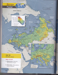
Use the attached instructions and the maps on 262-266 to create a sketch map of Europe. Scans of the physical and political maps are at the end of the post. To zoom in on any of the attachments- right click, then choose "open link in new tab" and you will be able to zoom in on the image.
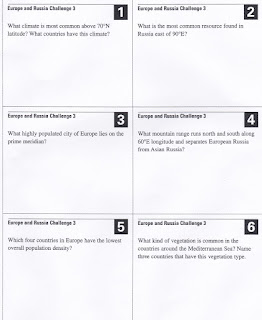
The attached images have questions that relate to the maps on pages 262-266. Along with your answer for each question, also write down the map or maps you used.


